Tuesday, October 13, 2015

Waldo Lake Kayaking

Prime time at Waldo Lake is summer's end, after the mosquitoes and summer forest fires have died down.  My daughter and I paddled and camped around this serene wilderness lake in September, 2015.  This was my first multi-day kayaking expedition and I hope to have many more.  We launched from the southeast corner of the lake at Shadow Bay.  The boat ramp parking area required day use fees or a forest service parking pass.  For camping, we used our backpacking gear and several dry bags.  Our boats were inflatable Air Fusion Elite kayaks, easy to transport and set up.
I added bungee cord rigging behind the cockpits so that large dry sacks could be secured.
Food bags were stowed in the hatches. I hung water bottles from the upper frame pole in front of the cockpit
We couldn't have asked for better weather.  The lake was calm and the sky was sunny.  Waldo is about 7 miles long and 1 to 2 miles wide. The west shore is a wilderness area where primitive lakeshore camping is allowed.  The east shore has 3 developed campgrounds which attract boaters, bikers (there's a 21 mile bike trail around the lake), and people who like to fish.  Waldo's pristine water is safeguarded by a ban on gasoline-powered motor boats.  Although fish can be found, Waldo is not stocked.  It's perfect for late summer camping trips and kayak tours.


I estimate that a strong kayaker with lots of energy could circle around the lake in a single day.  But we wanted to alternate our time on the water and on land, explore, and camp.  We set out in the late afternoon and soon arrived on the Western shore, just south of Klovdahl Bay.  I was mesmerized by the intense blue color of the deep water.  I felt I was dipping my paddle into a pot of blue paint.  Near shore, the water clarity is astounding.
Deep blue water


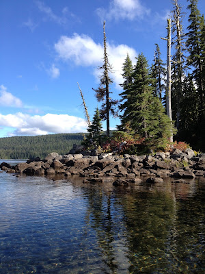
Much of Waldo's western shoreline has a rocky edge
We found a small cove with a sandy beach for our first camp.  I hiked in a ways, bushwacking, in an attempt to find the hiking trail that circles the lake.  Apparently the trail was far from our camp and I did not reach it.  During the day, chirping birds and buzzing bees created the sound space.  But around 6pm, an eerie silence began.  I became aware that I was listening to the sound of silence and it was beautiful.  Sunset was a visual feast and the night air became very moist.  We inverted our boats thinking that we would rather have dry cockpits the next day.  We didn't need to, because although it was misty at night and at sunrise, the morning sun was eventually strong enough to dry everything out.
Sunset and quietude on Waldo Lake

Early morning mist
Setting out on day two
We paddled past Klovdahl Bay and explored Rhododendron island.  There were some great camping sites there but we wanted to get further north for our second night of camping.  We encountered a few other kayakers and canoeists.  Two sailboats cruised up and down the lake.  If you're looking for solitude, you can find it here. We kayaked for another hour or two and found a good campsite at the tip of the prominent peninsula at the northwestern part of the lake.  For the most part, the forest is fairly dense right up to the lake shore, and much of the shore is rocky, so good campsites are not abundant.  That said, there are some small coves with sandy or graveled beaches and some areas of forest with clearings large enough for a camping.

Lakeshore campsite
Although bears inhabit the forest, they are not known to be problematic at Waldo Lake.  We didn't see any bears but we hung our food bag in a tree for good measure.  I'm sure that most bears would have no problem climbing a tree to get our food bag.  We couldn't get it up very high, but it kept the food odors far from our tent site, and if a bear got it, at least it wouldn't run through our camp to do so.  And it was kinda fun to hang the bag.


There are mountains all around Waldo Lake which are enchanting to watch as their colors and shadows change with the shifting angles of sunlight. The lake changes colors too, especially as you paddle into different depths.  Reflective water added to this dynamic beauty.
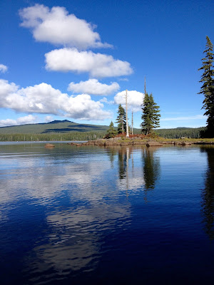
Waldo Lake reflections

Our second night out was clear, with no mist.  We were treated to an amazing nighttime sky.  The milky way was as thick as I have ever seen it.  We woke up to perfect weather on our third day, looking forward to a few hours on calm water for our return to Shadow Bay.  Close to Shadow Bay there were several small islands and peninsulas that were fun to explore.  After a couple of days in the wilderness, I was feeling very relaxed.  We took our time and savored the last day of our kayaking-camping expedition.

Relaxing on top of our boats in the middle of Waldo Lake

Wednesday, August 26, 2015

Rogue River Trail: lodge to lodge luxury

The idea of a four-day hike along a beautiful river without a heavy backpack is very appealing. Five friends and I decided to hike the Rogue River trail this June and stay in lodges along the way.


The Rogue River is known for it’s challenging whitewater rapids, rugged wilderness, and wildlife.  US congress designated part of the Rogue River as “wild and scenic” in 1968.  Popular with rafters, kayakers, fishermen and hikers, this section of the river is located west of Grants Pass in Southern Oregon.  A 41-mile trail parallels the river within the wild and scenic section.  Several primitive campsites are available by the river for hikers and boaters.  In addition, five different lodges offer meals and rooms from May through October.  We made reservations at three lodges.

We didn’t need to pack much because we weren’t camping or cooking. The lodges provide dinner, breakfast, and a sack lunch to take with.  Local river outfitters offer car shuttle services so that we could drive to the trailhead and then find cars waiting for us at trail’s end. 
Rogue River near Grave Creek Bridge
We started our hike near Grave Creek on the north side trail. A short trail on the river’s south side goes from Grave Creek Bridge to Raine Falls. There are no bridges beyond Grave Creek, so you must start on the north side if you intend to go beyond Raine Falls. 
Much of our first day was exposed and hot. As luck would have it, a late June heat wave settled in for the duration of our trip.  Being by the water helped keep the temperatures down, but it was still hot. The trail is high above the river nearly all the time. There are several creeks that empty into the Rogue.  These tributaries provide shade and cold water to beat the heat.  Some have deep enough pools for a nice dip.  Swimming in the river is an option, but the main trail is rarely by the river.  Side trails that lead down to the river appear fairly often but they tend to be overgrown with poison oak and blackberry bushes.  In contrast, the main trail was well maintained, thanks to the Siskiyou Mountain Club that recently worked on it.
One of the beautiful tributaries of the Rogue River
After cooling off near Bunker Creek, we took the cutoff to the beach for Black Bar Lodge.  A boatman came to ferry us across the river. They knew we were coming, so we didn’t need to holler across the river to get their attention.
A sturdy boatman manages the ferry across the river from Black Bar Lodge

Black Bar Lodge is small, beautifully rustic and very comfortable.  Good food was served up family style.  It was a lovely place to rest and share photos after a hot hike.
Dining and living room area at Black Bar Lodge
On the second day of our hike the trail was long but relatively flat.  We had great views of the river from up on canyon walls and the trail often veered into the forest where it was cooler.
Rogue River near Horseshoe bend
Shade was much appreciated
I went down a side trail to Zane Grey’s cabin.  Next to the river I found several private homes and some rustic constructions.
old cabin by the river
This building does not exactly match a photo of the original Zane Grey cabin that I saw online.  The siding and window are different, but it's in the right location.  Perhaps I did not find the right cabin!  The BLM purchased Zane Grey’s Cabin in 2008 and it is supposed to be open to the public.  Further downstream is Rogue River Ranch, a publicly owed historic ranch and museum.  It’s definitely worth a visit to learn about some of the local history.  I had visited it previously, so we skipped over it this time.
 It was great to relax on the patio at Marial Lodge after a 14+ mile hike.  Cold water and lemonade were freely provided with beer and wine available for purchase.  The food was remarkably good and there was plenty of it.
Dining room at Marial Lodge
The next day’s hike from Marial to Clay Hill was the shortest one of our journey.  It was still hot so we took advantage of cold creek pools and shady rest spots. We saw few groups of rafters on previous days, but for some reason, several more on the river this day. I had read that bears are more common on this lower part of the river, and sure enough we saw a black bear down by the river while on the trail.  Much of the hiking was high up on canyon walls and there were some areas of scree.
Hiking a nice trail on canyon walls above the Rogue River
I suppose it’s possible to miss the short cutoff trail for Clay Hill lodge if you’re deep in thought and don’t see the buildings.  Most of us noticed it right away.  It’s located on a very placid section of the river.  You can hike or float to Clay Hill, or you can motor boat up from a downstream launch at Foster Bar.
Clay Hill Lodge
The placid Rogue near Clay Hill
Early on the fourth (and last) day of hiking we stopped at Flora Dell Creek where a 30-foot waterfall plunges down into an inviting pool. We worked together to haul out a large tree that had fallen into the water.  The goal was to improve the swimming area.  I swam in this magical pool while others explored the cliff walls and discovered a treasure chest.  My guess is that the chest was left there in the spirit of geocaching fun.

Flora Dell Falls, named for a pioneering resident of Clay Hill, Flora Dell
The pool at Flora Dell Falls is perfect for swimming
Pirate's chest at Flora Dell
The last day of hiking included various terrain; canyon walls, forested paths, shady creeks, and a large private cattle ranch. A chorus of mooing cattle serenaded us near the trail’s end.  The wild and scenic Rogue River Trail was an excellent adventure and one that I would happily do again.
A calm stretch of the wild and scenic Rogue River 
Please post a comment below.  Share any great hikes you have done!

Thursday, August 13, 2015

Lost Coast Trail: time and tides wait for no one

California's Lost Coast Trail in the King Range is a prime backpacker's destination.  I wanted to do this trail for many years and finally hiked it with my youngest daughter last July.  The path is often close to the ocean's edge and impassable at several spots during high tide. I checked local tide tables beforehand and knew that a high tide would occur at 5 pm our first day on the trail.  To be safe, we needed to make it through the "impassable at high tide sections" by 3 pm.  We thought that would be easy.  Ha!
This map of the first day's hike doesn't show the many creeks and campsites we past. 

We took a 6:30 am shuttle ride to Mattole Beach and left our car at the trail's end point, Black Sands Beach at Shelter Cove.  The distance between the two beaches is only 27 miles (by trail) but the shuttle ride took two hours, due to mountainous terrain and tortuous roads.  Before beginning our hike, we had breakfast at Mattole campground and registered for the hike.  Several other groups of hikers set out upon arrival so they were a good half hour in front of us.  The Lost Coast Trail a popular destination.
The hike started out on sandy dunes and dried grassy meadows but soon hugged the coast and some terrific tide pools.
Mattole Beach.  The morning clouds burned off early.

Tide pools on the Lost Coast Trail

Low tide with lots of interesting creatures in the pools
I love to poke around in tide pools so it was hard for me not to dally here.  I knew that we had miles of rough terrain ahead.  Not long after the tide pools we past Punta Gorda lighthouse and a few sea lions who were lolling in the sand.
Punta Gorda lighthouse

Soon the beach became narrow and rocky.  It was slow going, and often involved rock-hopping... not so easy with a heavy pack. Well, to be honest, I don't carry a heavy pack.  It's a relative thing, my pack feels heavy to me, but light to my daughter.  She cheerfully carried the bear-proof food canister and our tent.  It was great to have such a wonderful hiking partner! We took breaks on this long, difficult section to rehydrate, snack and watch seals and sea birds.  An eerie aspect of this section is the noise that the surf makes when it crashes on rocks and tumbles them in its rolling wave action.  You hear the constant din of clattering rocks, a reminder of the ocean's power.
Watch your steps on these ankle-twisting rocks.
It was close to high tide, 3pm, when we rounded the last big rock of the "impassable at high tide" section.  To stay dry, we waited for a wave to come in and then flow back out before running around the rock.

Last rock-run-around before Randall Creek camp
We made it, dry and safe, to our first camp at Randall Creek although it wasn't a leisurely hike at all. An hour later, we would not have made it around the last rock without getting splashed and possibly knocked over by a wave.  Randall Creek camp is beautiful.  It's located about a mile up from the cutoff to Spanish Ridge.  We chose a spot up on the meadow.  Other campers selected sites closer to the creek and more protected from possible winds.  Lucky for us there was little wind and we enjoyed the fabulous ocean view.

Randall Creek campsite on the Lost Coast Trail, five star backcountry accommodation!
 Filtering water and otter watching on Randall Creek
Wildflowers were still blooming at Randall Creek and the pools there were deep enough to wade into.  We saw a river otter who ran with agility over the rocks and driftwood. I love how backpacking gets me back to basics. The focus is on simple aspects of life: food, water, shelter, fitness, and coexisting with nature.  Nature, of course, has the upper hand.
A short, easy hike was slated for the next day.  We hiked the easiest section of the Lost Coast Trail from Randall Creek to Big Flat in about 4.5 hours.  The trail was mostly flat and goes through meadows.  Earlier in summer the wildflowers must be astounding but we were too late for that.  I was grateful for an easy hiking day because I had already begun to get blisters.  I bandaged them to minimize further damage and switched into sandals whenever possible.  Big Flat offers more than a dozen excellent campsites by the sea with lots of driftwood shelters.  We selected a spacious site with extra large driftwood logs.
Big, flat, grassy meadow on the Lost Coast Trail
Evening fog flowing up Rattlesnake Ridge near Big Flat Creek
Campsite at Big Flat
We made camp early, relaxed and washed up.  The next section of the trail would be a long "impassable at high tide" stretch that we did not want to attempt during any time close to high tide. We made a delicious dinner and enjoyed watching deer, rabbits, seals, and seabirds.
The next day, our third day, we could have easily walked all the way to Shelter Cove, our end point.  Instead, we stopped about 2 miles from the end to enjoy a third night of camping.  We were lucky to have fine weather and excellent campsites. The hike through the final "impassable at high tide section" was similar to the previous impassable section, very rocky.
A short climb is required to get down to the trail near the water's edge.
Some of this section was very rocky.
Sandy sections were easy on my tired feet. There were lots of seals and birds to watch.
Cormorants in the morning fog
Our third and last campsite was at Horse Mountain Creek.  Few people camp here because it's so close to the end of the trail.  It's a lovely site with fresh water, driftwood wind protection, and a warm, black sand beach.
Horse Mountain Creek, home to river otters

Beautiful campsite with a wide black sand beach

The black sand is clean and warm.  It feels great to lay on it.
There were a few snags: we ran out of fuel on the last day and needed to move the tent in the middle of the night due to high winds.  This didn't bother us much.  The natural beauty around us, the sea life and our hiking success made me gloriously happy most of the time.
The sleepy town of Shelter Cove was our destination the next day.  We walked two short miles over sand and some rocks.  Seals popped up near the shoreline and the sun was shining. It began to sink in to me that we had just completed a great adventure.
Trail's end! 

Last selfie on the Lost Coast Trail.  We did it!

Please post your comments and questions about this blog.
What were your experiences like on backpacking trips?
Do you have suggestions for other amazing trails?

Tuesday, August 11, 2015

Welcome to My Hikes and Paddles


I’m glad you’re here, reading my new blog.  I enjoy reading blogs about outdoor adventures that I might attempt and I want to contribute some of my own.  I love summer because that’s when I get a break from my academic job and have the freedom to do lots of hiking, kayaking, swimming, biking and other fun stuff.  I live in Southern Oregon where there are countless mountain peaks, forests, rivers, lakes, and coastal environments.  I’ll be describing some of these wild places in my blog posts.  I hope this blog will connect me with other like-minded people.  Please comment on my posts and describe or leave links to your hikes and paddles!
Me, paddling on Spring Creek